




4.5
Free
Image Compare
Efficient Image Comparison Tool for Android
 MemorialApps
Safe & trusted downloads
The best software, verified by experts

Efficient Aerial Imaging with Drone Surveyor
Drone Surveyor is a utility app tailored for drone pilots, enabling them to capture high-resolution aerial images efficiently. Designed for use with various DJI drones, the app allows users to delineate specific survey areas on a map, customize flight parameters, and save missions for future use. With its straightforward interface, users can easily manage their aerial photography tasks, making it an invaluable tool for both hobbyists and professionals.
Key features include the ability to adjust flight altitude and speed, set flight path orientation, and access a mission gallery where photos can be viewed and processed. With notifications for completed image processing, Drone Surveyor enhances the overall workflow for capturing stunning aerial imagery. This app supports a wide range of DJI drones, ensuring compatibility for many users.
Drone Surveyor (for DJI) for Android
Free
Efficient Image Comparison Tool for Android
Free
Comprehensive Drone Control with Go Fly App

Free
Fleetlog: The Essential Tool for Planespotters
Free
Efficient Image Compression with PicShrink

Free
Enhance Your Drone Experience with Maven Lite

Free
Motion Stacks - Image Stacking
Water Clone - 32 bit support
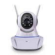
Wifi Camera App Overview

All State Lottery Results Overview

MobCup Ringtones & Wallpapers: Exciting Phone Customization

A free program for Android, by TECHNOPARK.

Efficient QR Code Scanning Tool

Comprehensive HMI/SCADA Solution for Android

Voice Call Changer Call Recorder: Change Your Voice During a Phone Call

DSS Agile: The Mobile Client for DSS Products

A free app for Android, by GoNext.